
Projects
Europe 2040
Anticipation mapping
Europe 2040 is a map produced in 2021 anticipating the administrative situation of Europe in 2040. It is based on current political and territorial issues as well as on the logical continuation of some ongoing processes.
In this perspective, the European Union would be strengthened (without being considered as one and the same State).
An internal enlargement (Scotland, Wales, Catalonia, Flanders, Wallonia, Gibraltar, Jersey and Guernsey) and external (Serbia, Montenegro, Albania, North Macedonia, Ukraine and Georgia) would have taken place. Following the partition of Belgium into two Member States, the Brussels region would become an autonomous European District.
England, reduced, would be an associate member under EFTA, as would the Faroe Islands, joining Switzerland, Iceland, Norway and Liechtenstein.
As for the candidate states, only Turkey, Kosovo and Bosnia-Herzegovina would be compatible with the Copenhagen criteria. Russia, Belarus and Azerbaijan would remain too authoritarian and Armenia too attached to its relations with Russia.
The democratic attachment of Moldova to Romania would bring to mind a persistent problem : certain de jure European territories would still escape the control of Brussels. These are Transnistria, Gagauzia, Northern Cyprus, Donbass, Crimea, Abkhazia and South Ossetia. The admission of Turkey and the expansion of the Schengen area could ultimately provide lasting solutions to these status quo.

French Plurinational Republic
Uchronic mapping
This map, which is only of interest when printed in A3 or zoomed, answers an unlikely question :
What if France was a plurinational
and decentralized state,
[like Spain or Bolivia] ?
This hypothesis, improbable in view of the French constitution and the deeply Jacobin political tradition, questions issues that are nevertheless very real : the recognition of regional languages, institutional decentralization or even the redistribution of the territorial "mille-feuille".
In this constitutionally plurinational France, French remains the official language over the entire territory, but the other languages are co-official in the communities concerned : thus, a Béarnais or an Alsatian can carry out their administrative procedures in Occitan or Alsatian. Hence the interest in indicating the toponyms in the local language, as in Spain, and the title in Occitan, Corsican, Breton, German, Catalan, Basque, Flemish and Franco-Provençal, in addition to French.
The autonomous regions have elected regional governments allowing them a better adaptation to the territories of state competences. Each can democratically decide on the internal autonomy of a community, like Brittany with its customary countries. Paris, including the departments of the "Little Crown" becomes an autonomous federal district, like Washington DC or Buenos Aires.
Choosing a new division is not easy : it is not simply a question of taking up the traditional extent of the use of dialects, because they are not equivalent to current regional identities, nor to the former French provinces, which are obsolete. and do not all correspond to contemporary social realities.

Vexilli Romani
Uchronic vexillology
The concept of flag as accepted today did not exist in Latin Antiquity, and therefore any vexillological conception can only be anachronistic. It is from this problem that Vexilli Romani was born : to give a flag not to the Roman Empire, but also to each of the provinces, conuentus and client states, as well as to the city of Rome, erected in districtus foederalis.
A collection of 160 flags representing 150 subdivisions, 8 client states, the city of Rome and the Roman Empire has been produced, some prototypes of which are visible opposite.
The design of these flags required research and documentation taking into account the ancient ethnic and cultural reality, the history of the said territory, the physical geography, as well as, as a last resort, the correspondence with the current territory.
If for certain subdivisions symbols or colors are attested to us from Antiquity, it was necessary for others to draw inspiration from their geographical position, or even from current cultural reality.
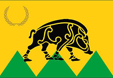
All, however, meet a requirement : like Soviet or British territories, one element, the laurel wreath, is used and displayed on each flag.
Gallia Aquitania Prima
(Massif Central, in France)

Imperium Romanum

Phrygia Salutaris
(in present-day Turkey)

Districtus Foederalis Roma


Regnum Colchidis
(Georgia)
Honorias
(in present-day Turkey)

Praeualitana
(Montenegro)

Coele Syria
(Syrian coast)

Flauia Caesariensis
(central England)
Religion in Lebanon
Ethnolinguistic and religious mapping

This map, produced in Spanish, depicts the religious distribution in Lebanon in the early 2010s.
For the sake of clarity, only the most represented denominations (Maronite Christians, Armenians, Greek-Catholics and Greek-Orthodox, Druze, Alawites, Shiites and Sunnis) are mentioned.
The Lebanese religious demography being of recognized diversity and constantly evolving, inaccuracies and irregularities cannot be ruled out, a fortiori in a turbulent migratory context.
Territorial Entwicklung of the Habsburger Monarchy
Historical summary cartography


A blank map summarizing the territorial expansion in Europe of the Habsburgs, a family originating from northern Switzerland having reigned over various states throughout history, from Spain to Austria and the Netherlands and to Mexico.
Although not captioned, the territories concerned, in green, are added to the current borders (white outlines), giving a better account of the extent of what was the Habsburg phenomenon.
The only difference between the two maps is the inclusion or not of the territories subjected to the yoke of the Habsburgs when they reigned over the Holy Roman Empire, de jure suzerainty but not very effective.